
Bridgeburg plan will seek to balance growth with environment
June 9, 2026 at 10:02 AM


Councillors on Monday evening got an early peek at what the future plan for Bridgeburg may look like.
While many of the finer details for the Bridgeburg North Secondary Plan are still to come, staff provided council with an update on the project, which will help guide development in a key part of Fort Erie.
The plan will likely include areas of low- and medium-density development, but staff said there’s also a clear desire to protect the area’s natural features.
“There’s been a strong and consistent message throughout that residents and stakeholders support growth but want to ensure that development respects natural features and maintains the character of the area,” said Linda Redmond, senior policy planner for secondary planning with the Town of Fort Erie.
Specifics for densities are yet to come, but Redmond said residents can expect a mix of low density, such a detached homes and street townhouses, as well as medium density builds like block townhomes and low rise apartments.
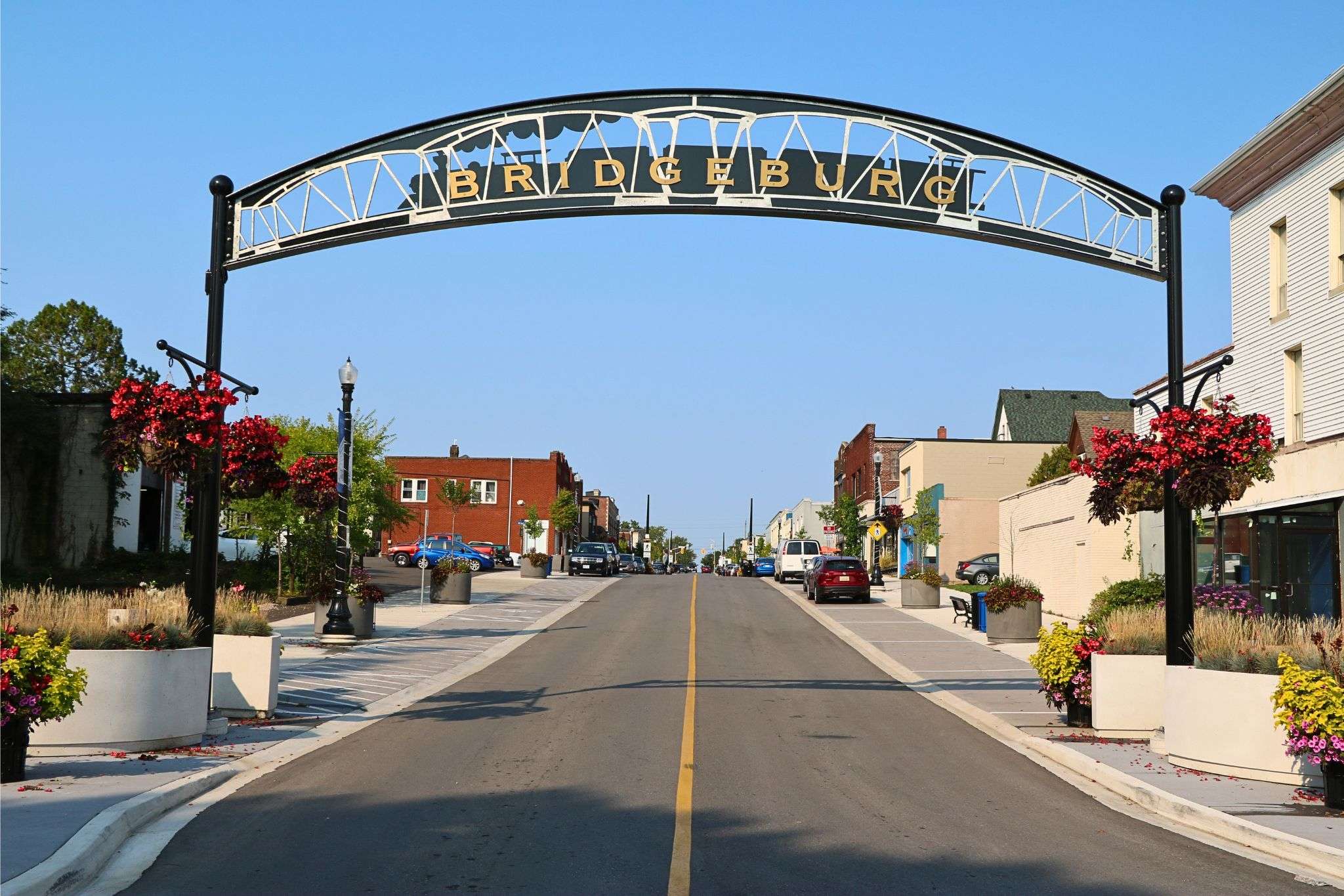 Bridgeburg’s welcome sign on Jarvis Street. Credit: Town of Fort Erie | Facebook
Bridgeburg North has previously been identified as Fort Erie’s “highest-priority secondary plan project,” the staff report said.
Planning for the area experienced delays due to a provincial appeal and because significant environmental and servicing studies hadn’t been completed.
But with the province withdrawing an appeal regarding the Bridgeburg North Urban Expansion Area and with those studies being completed, staff are now looking to move into advanced phases. That includes a community focus group, which has been formed and met earlier this year.
According to the staff report, the early themes that came out of the focus group included: balancing growth with environmental protection, improving connectivity, supporting a complete community, leveraging natural and recreation assets, and infrastructure readiness.
Work now includes a more detailed land use concept, including more specific ideas of where parkland, active transportation and stormwater management facilities should be located.
Mayor Wayne Redekop questioned one of the findings that suggests a crossing of Frenchman’s Creek may be required.
“Why would there be a need for, a) a crossing from north to south, and b), why would it be advisable to be going through an environmentally protected area?” he asked.
Barb Wiens, with Upper Canada Consultants, said there are a few reasons.
“One of the elements that is driving…the need for a crossing is the sanitary sewer,” she said, pointing out other wastewater options may require a pumping station.
A crossing would also improve connectivity, she added, though pointed out the exact nature of the crossing is yet to be determined.
If there is a crossing, there’d be a full environmental assessment process.
Remaining phase two and three studies are expected to be completed this summer, along with refining the land use concept. A draft secondary plan is expected to be up for public review and council consideration in the fall.

Report on new Bay Beach revenue options coming in March
Fort Erie to consider traffic calming measures on Farr, Concession and Washington
Town punts approval of Hazel Street townhouse development
About The Author

Luke Edwards
Luke Edwards is a longtime Niagara community journalist who has covered a variety of beats, including business, agriculture, the wine industry and politics. When not writing, there's a good chance he can be found at a baseball diamond or curling rink.

Stay Informed